
Miami Beach residents heading outdoors this week face a heat index above 105 degrees as the region's 39-day streak of 90-degree-plus temperatures pushes toward the all-time record of 56 consecutive days, set in 2023.
WSVN meteorologist Dylan Federico reported Sunday, July 19, that highs will trend into the mid-90s by the end of the week, with additional heat advisories likely.
"We may threaten the all-time record of 56 days in 2023 — with a seemingly endless streak of 90 degree days ahead," Federico wrote in his forecast blog.
The streak means anyone walking Lincoln Road, lounging at Surfside beach, or catching events at Lummus Park will feel triple-digit heat indexes during peak afternoon hours through at least Friday, July 25. A heat advisory was already in effect across Miami-Dade on Friday, July 18, when the heat index reached 110 degrees, according to CBS Miami.
Monday, July 20, is forecast to be the week's driest day, with isolated storms staying inland and highs in the lower 90s. Rain chances remain below average through most of the week, Federico said, though an upper-level disturbance could bring some relief by the weekend.
What to do about the heat
Miami Beach has not issued a separate heat advisory beyond the county-wide one. Residents should limit outdoor activity between 11 a.m. and 7 p.m., when heat advisories are most likely in effect. Cooling center locations are available through Miami-Dade County and can be found at miamidade.gov.
Tropical Depression 2 forms in the Gulf
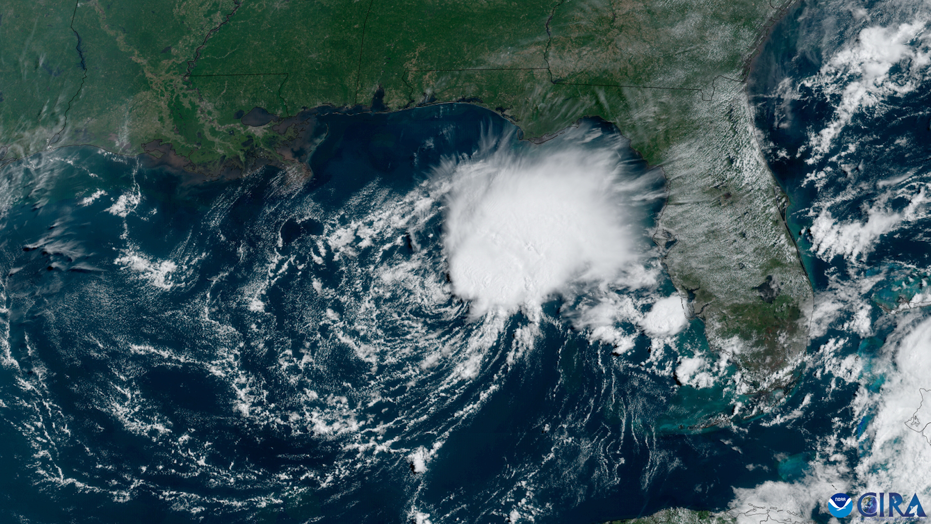
A separate weather concern emerged Sunday, July 19, when Tropical Depression 2 formed in the Gulf of America. As of the National Hurricane Center's 5 p.m. advisory, the system packed winds of 30 mph and was stationary.
A tropical storm watch is in effect from the Florida Panhandle to the Alabama-Florida border. The NHC said the depression is expected to strengthen gradually and could bring tropical storm conditions to portions of the Panhandle.
For Miami Beach, the system's rain bands already extend from South Florida to the Louisiana-Mississippi border, making it large but distant. Forecasters expect TD2 to track slowly westward along the northern Gulf Coast, with landfall projected in Louisiana or Texas later in the week.
Forecasters expect wind shear and Saharan dust to limit TD2's strengthening on its current westward track, making hurricane development unlikely, according to USA Today. Federico noted that near-record Gulf water temperatures could fuel rapid intensification only if the storm shifts significantly southward.
If the system strengthens, it would be named Tropical Storm Bertha, the season's second named storm after Tropical Storm Arthur formed in June, according to USA Today.
What to watch this week
Residents should monitor the National Hurricane Center at nhc.noaa.gov for updated TD2 advisories. The forecast is subject to change as the system evolves. The heat streak, at 39 days and counting, would need to reach Aug. 5 (56 days) to tie the 2023 record.





.jpg)